-
UN climate change conference reference handbook COP1-COP30
 Cambodia
Books and book chapters
2025
This handbook is intended to serve as a reference document for the upcoming United Nations Climate Change Conference (COP30), known as the 30th Conference of the Parties to the ...
Cambodia
Books and book chapters
2025
This handbook is intended to serve as a reference document for the upcoming United Nations Climate Change Conference (COP30), known as the 30th Conference of the Parties to the ...
-
Clean air plan of Cambodia (CAPC)
Cambodia
Books and book chapters
2021
The Clean Air Plan of Cambodia (CAPC) is a national strategic document aimed at defining activities to reduce air pollutant emissions in Cambodia. This strategic document provid...
-
Operations manual for the implementation of article 6 of the Paris Agreement on climate change in Cambodia
 Cambodia
Guidelines, instruction manuals, handbooks
2024
The Royal Government of Cambodia (RGC) signed an authorization on 14 December 2024, allowing the Minister of Environment to launch the Operations Guidelines for implementing Art...
Cambodia
Guidelines, instruction manuals, handbooks
2024
The Royal Government of Cambodia (RGC) signed an authorization on 14 December 2024, allowing the Minister of Environment to launch the Operations Guidelines for implementing Art...
-
Cambodia national action plan on drought management and adaptation 2025-2030
Cambodia
Action Plan
The Cambodia national action plan on drought management and adaptation 2025-2030 aims to increase the capacity to forecast and prepare for drought risks and prioritizes early wa...
-
Cambodia climate resilient and integrated water resources management (IWRM) action plan 2026-2030
Cambodia
Action Plan
This action plan promotes climate-resilient, integrated, and multipurpose water resources management. It strengthens the capacity of institutions and stakeholders while advancin...
-
AI for Sustainable Development in ASEAN: Advancing Safe, Trustworthy and Ethical AI for Climate Action
Cambodia, Indonesia, Lao People's Democratic Republic, Malaysia, Myanmar, Philippines, Thailand, Timor-Leste, Viet Nam
Reports, journal articles, and research papers (including theses and dissertations)
Kristian Steele, Arina Koul, Jill Leung, Ying Hong, Chester Ling,...
2025
This report explores the transformative potential of AI in addressing climate challenges across Southeast Asia, emphasising the need for targeted interventions to harness AI eff...
-
Cambodia's path to sustainability: accelerating national priorities through climate actions
Cambodia
Reports, journal articles, and research papers (including theses and dissertations)
UNDP Cambodia
2025
This report analyses the priorities in Cambodia’s strategic development and climate documents and identifies key synergies, gaps and opportunities for integrated action. While i...
-
Report on youth engagement in Cambodia’s nationally determined contribution (NDC)
Cambodia
Reports, journal articles, and research papers (including theses and dissertations)
Anh H. Nguyen, Pengsan Huon, Socheata Horng
2024
Empowering young people to be effective climate leaders is essential for forging a collective impact and solving the existential issues of climate change. For this purpose, UNDP...
-
Cambodia Climate Change Alliance - phase 3 (CCCA3) achievements
Cambodia
Reports, journal articles, and research papers (including theses and dissertations)
Ministry of Environment
2024
The current third phase (2019-2024) has invested in improving transparency mechanisms, developing the legal and policy framework securing the engagement of the Ministry of Envir...
-
Cambodia climate expenditure review 2023
Cambodia
Reports, journal articles, and research papers (including theses and dissertations)
Ministry of Environment
2024
In 2023, climate change expenditure remains at 2.1% of GDP, about the same level as in 2022 and KHR 2,769 billion, reflecting the increase in the construction of water infrastru...
-
Public Disaster Prevention and Mitigation Act, B.E. 2550 (2007)
Thailand
Act
August 28, 2007
In this Act: “public disaster” means fire, windstorm, flooding, drought, epidemic in humans, in animals or in marine animals, or invasion of plant pests, including other disaste...
-
The climate dictionary
Cambodia, Global
Books and book chapters
2024
The Climate Dictionary is an initiative aimed at providing an everyday guide to understanding climate change. It seeks to bridge the gap between complex scientific jargon and th...
-
Climate change data art exhibition report
Cambodia
Advocacy and promotional materials
2024
This report illustrates the Climate Change Data Art Exhibition on 10 December 2023, which took place at Prayuters Library in Hmor Seth village, Sangkat Pal Hal, Krong Preah Vihe...
-
Rainfall stations
Cambodia
May 28, 2019
Source: GIS portal of the Ministry of Environment of Cambodia...
 This dataset reveals 98 locations of hydro-meteorological stations disperse in 18 provinces in Cambodia.
-
Rainfall estimates from rain gauge and satellite observations (CHIRPS pentad dataset)
Cambodia
June 23, 2022
Source: The data is derived from...
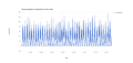 CHIRPS is an abbreviation for Climate Hazards Group InfraRed Precipitation with Station Data (Version 2.0 final). The CHIRPS is a 30+ year quasi-global rainfall dataset and inco...
-
Sub-decree No.228 on the establishment of Boeung Karde multiple use area
Cambodia
228
Sub-decree
November 5, 2021
This sub-decree shows the establishment of Boeung Karde multiple-use areas with an area of 1,643 (one thousand six hundred and forty-three) hectares in the geographical distri...
-
USAID GREENING PREY LANG Northern Plains Landscape REDD+ Feasibility Assessment
Cambodia
Reports, journal articles, and research papers (including theses and dissertations)
Kyle Holland, Jeff Silverman and Colin Moore, Tetra Tech and WCS
2018
The Northern Plains Landscape (NPL) of Cambodia encompasses the intersection of natural habitat, biodiversity, and people. A woven system of critical forests and wetlands, the l...
-
Air Quality: Carbon Monoxide
Cambodia, China, Indonesia, Lao People's Democratic Republic, Malaysia, Myanmar, Thailand, Viet Nam
February 10, 2022
Source: Sentinel-5P:...
Carbon monoxide (CO) is an important atmospheric trace gas for understanding tropospheric chemistry. In certain urban areas, it is a major atmospheric pollutant. Main sources of...
-
Law on disaster management
Cambodia
NS/RKM/0715/007
Law
July 10, 2015
The objective of this law is to manage the disaster in the Kingdom of Cambodia.
-
Earthquake Disaster Areas in Thailand
 Thailand
May 31, 2021
Source: Open Government Data of Thailand (https://data.go.th/dataset/eqzone)
Earthquake disaster area: using a model program to develop the area that may be affected by earthquakes in Thailand.
Thailand
May 31, 2021
Source: Open Government Data of Thailand (https://data.go.th/dataset/eqzone)
Earthquake disaster area: using a model program to develop the area that may be affected by earthquakes in Thailand.