Skip to content

Forest cover in Cambodia (2015-2022)

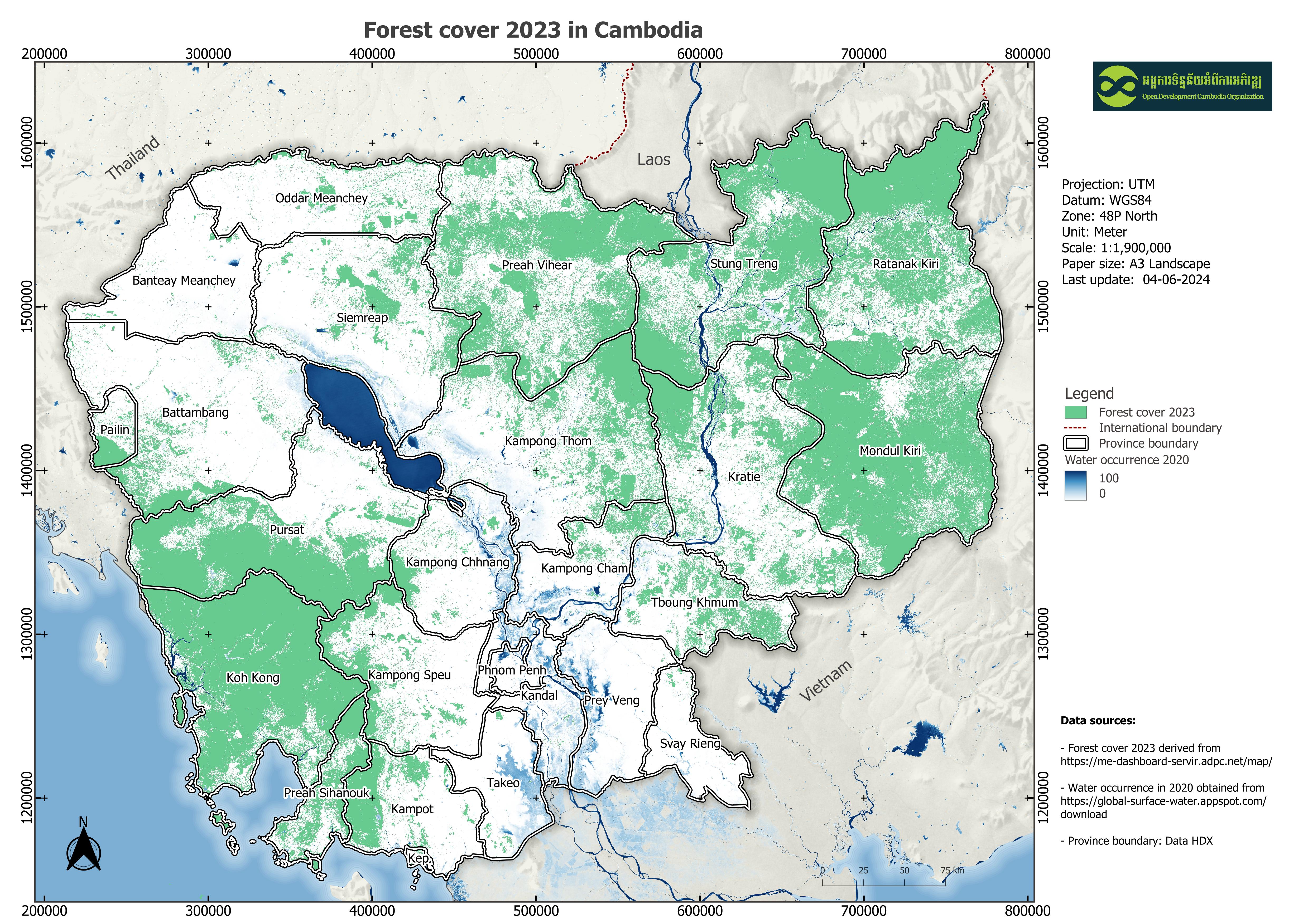
Through the implementation of USAID's Supporting Forests and Biodiversity (USAID SFB) ensuring ecological stability and biological productivity for landscape management and conservation policy, along with other stakeholders in Cambodia, the effective biodiversity and related conservation projects over large areas in Cambodia context were required insight's reports so as to have been developed Biophysical M&E Dashboard tool by SERVIR-Mekong, monitoring the performance of landscape-scale efforts and biophysical conditions on the ground. In this tool development, the input data are opened and available data on the Google Earth Engine (GEE), including Enhanced Vegetation Index from MODIS (MOD13Q1), tree canopy cover and tree canopy height to characterize forest extent and change from the Global Land Analysis & Discovery of University of Maryland (GLAD/UMD) team for the Mekong region, forest alert from GLAD Alert product from UMD and SAR Alert System (SARAS), forest fire from the Fire Information for Resource Management System (FIRMS), and the Cambodia national Land Cover times series (2000-2022) through a collaborative effort of SERVIR-Mekong using the Regional Land Cover Monitoring.

This dataset section focuses on Cambodia's annual forest cover. The quantitative data about the area of forest cover is derived from the tool and compiled to be available to download from 2015 to 2022 for purposes.

Data Resources (28)

Data Resource Preview - Forest cover 2022

Additional Info

Field Value
Dataset topic category Forest cover
Language
  • English
Use limitations By accessing this website or database, users agree to take full responsibility for reliance on any site information provided and to hold harmless and waive any and all liability against individuals or entities associated with its development, form and content for any loss, harm or damage suffered as a result of its use.
GeoNames
  • Cambodia
West bounding coordinates 102.47599422714293
East bounding coordinates 107.61293415187792
South bounding coordinates 10.44836556610326
North bounding coordinates 14.704060769134802
Spatial Reference System WGS 84 / UTM zone 48N (EPSG:32648)
Process Step Data was downloaded from the dashboard of https://me-dashboard-servir.adpc.net/map/. The dashboard framework has used recent technological advances to enhance computational capabilities and facilitate an increase in public access. In this regard, the Google Earth Engine application is integrated into the framework to compute a cloud-based data catalog.
Responsible party - SERVIR SEA - ASIAN DISASTER PREPAREDNESS CENTER (ADPC) Head Office No. 979/66-70, SM Tower, 24th Floor, Phaholyothin Road, Phyathai, Bangkok 10400, Thailand Tel:+66 2 298 0681-92 Fax:+66 2 298 0012 Email:adpc@adpc.net BTS Skytrain: Sanam Pao, Exit 1
Metadata creator information Metadata last updated on 2023-07-14. For inquiries contact: Open Development Cambodia, Email: contact@opendevcam.net, Website: http://www.opendevcam.net Address: 23B St. 606, Phnom Penh, Cambodia
Attributes Raster value: 1: Forest cover
License Creative Commons Attribution Share-Alike
Copyright Yes
Keywords Forest
Date uploaded February 3, 2022, 03:57 (UTC)
Date modified October 19, 2023, 08:31 (UTC)