Hydropower Dams in Myanmar 2017
Published by: Open Development Myanmar
Data Resources (7)
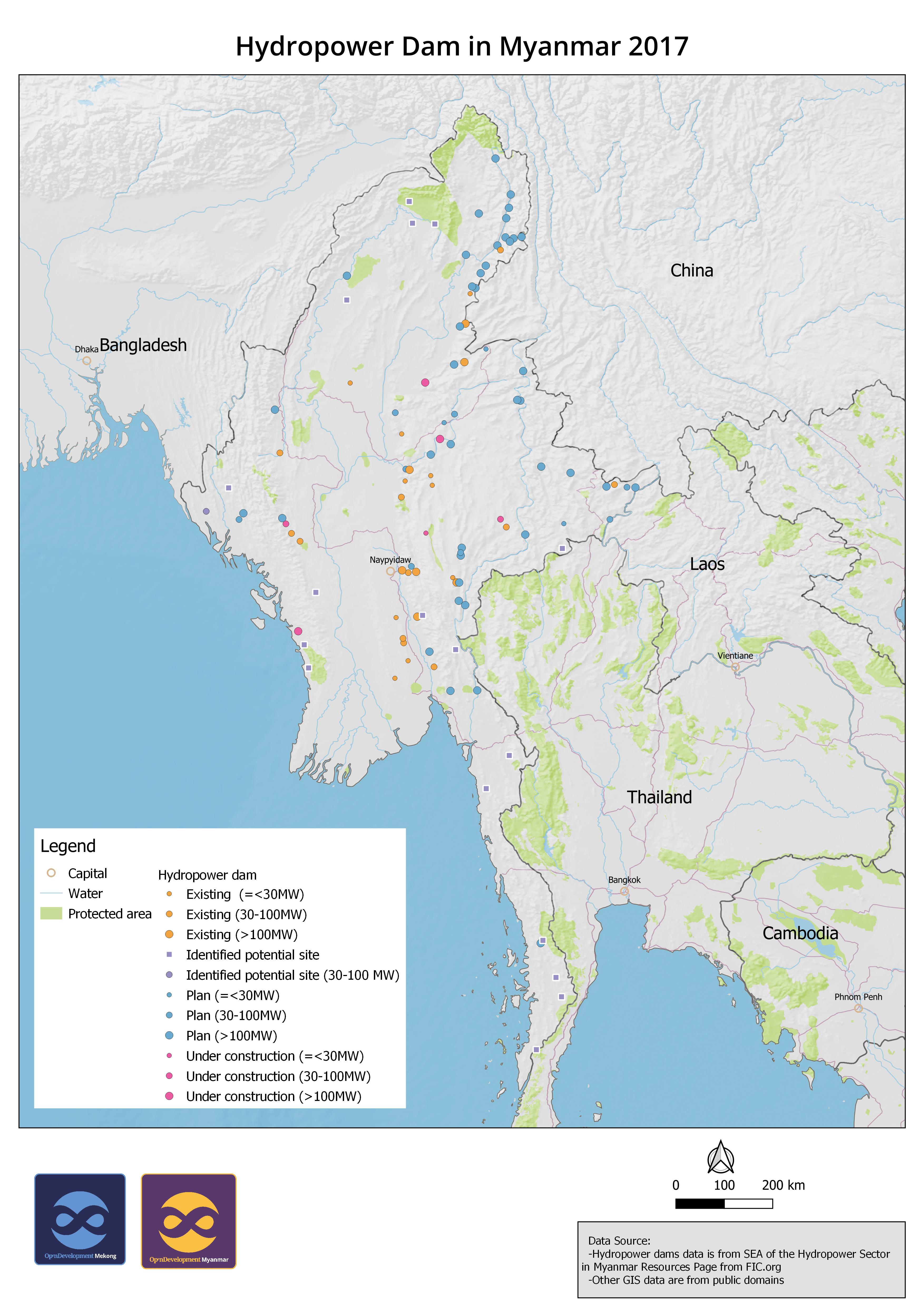
Data Resource Preview - [English] Hydropower Dam in Myanmar 2017
Thông tin khác
| Miền | Giá trị |
|---|---|
| Ngôn ngữ |
|
| Hạn chế truy cập và sử dụng | There is no information about use limitation. |
| Ngày tham chiếu của bộ dữ liệu | 1 tháng 1, 2017 |
| Ngày kết thúc của phạm vi tạm thời | 1 tháng 1, 2017 |
| Cơ sở dữ liệu dịa lý |
|
| Các tọa độ ranh giới phía Tây | 92.6521835327148 |
| Các tọa độ ranh giới phía Đông. | 100.720932006836 |
| Các tọa độ ranh giới phía Nam. | 10.7752084732056 |
| Các tọa độ ranh giới phía Bắc. | 27.5259418487549 |
| Hệ tham chiếu không gian | WGS 84 (EPSG:4326) (CRS:84) |
| Độ chính xác định vị | There is no information about positional accuracy. |
| Tính đầy đủ | There is no information about completeness. |
| (Các) quy trình thu thập và xử lý dữ liệu | The original data was downloaded and cleaned for producing geospatial data. The records with abbreviation were added with full words from publication. Then the data was converted to SQLite for uploading to GeoServer for visualization. |
| (Các) nguồn | International Finance Corporation (https://www.ifc.org/wps/wcm/connect/industry_ext_content/ifc_external_corporate_site/hydro+advisory/resources/sea+of+the+hydropower+sector+in+myanmar+resources+page) |
| Giấy phép | Creative Commons Attribution Share-Alike |
| Bản quyền | Yes |
| Phiên bản | 1.0 |
| Các từ khóa | hydropower myanmar |
| Ngày đăng tải | tháng 10 20, 2020, 00:38 (UTC) |
| Ngày chỉnh sửa, cập nhật | tháng 11 11, 2020, 03:03 (UTC) |