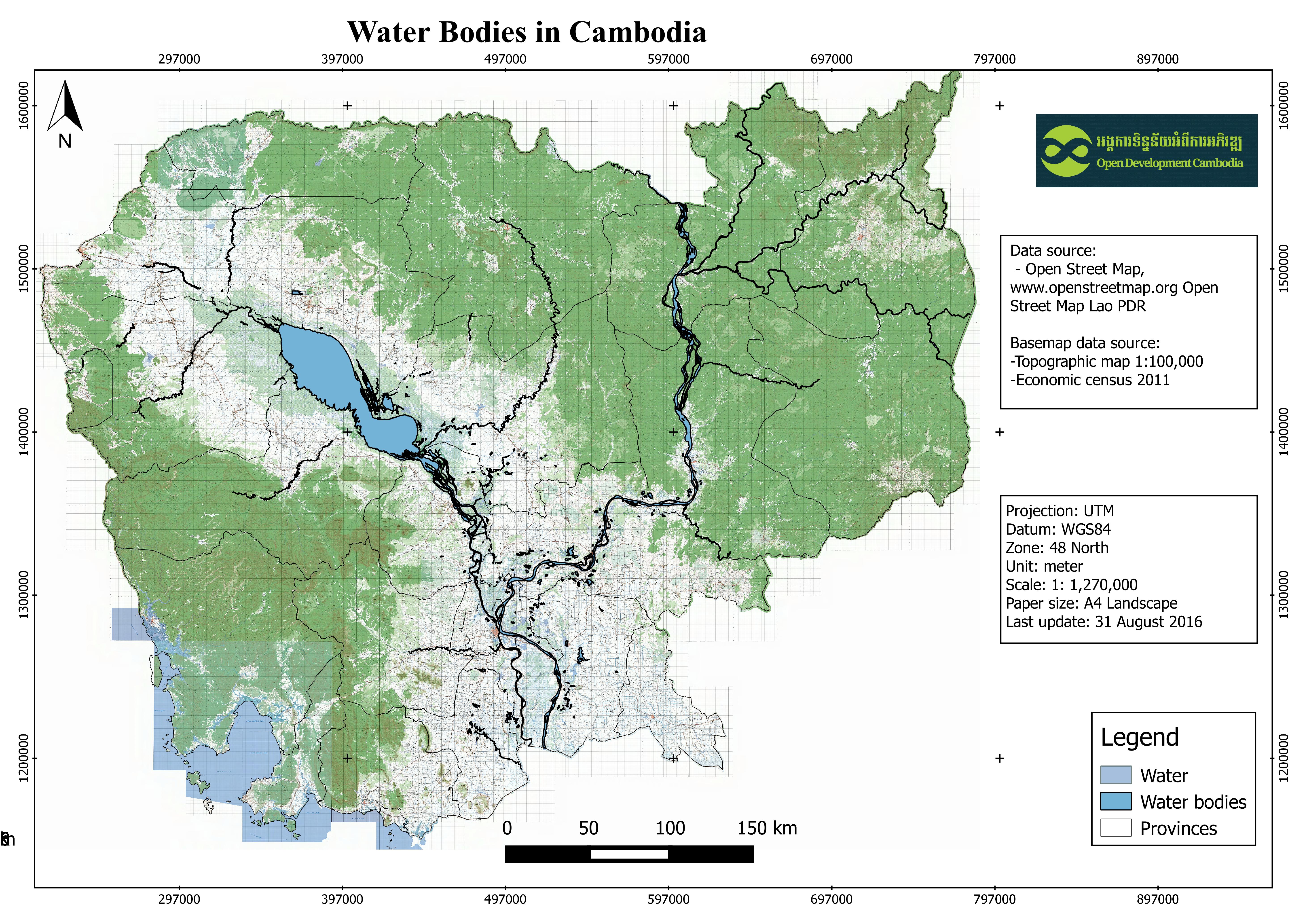
Water bodies in Cambodia
Published by: Open Development Cambodia
Data Resources (7)
Data Resource Preview - Water bodies in Cambodia
Thông tin khác
| Miền | Giá trị |
|---|---|
| Loại chủ đề của bộ dữ liệu |
|
| Ngôn ngữ |
|
| Hạn chế truy cập và sử dụng | Access and use constraints are depend on Open Street Map Lao on the website: http://www.openstreetmap.la/ |
| Ngày tham chiếu của bộ dữ liệu | 11 tháng 11, 2015 |
| Cơ sở dữ liệu dịa lý |
|
| Các tọa độ ranh giới phía Tây | 102.551643371582 |
| Các tọa độ ranh giới phía Đông. | 107.88102722168 |
| Các tọa độ ranh giới phía Nam. | 10.287540435791 |
| Các tọa độ ranh giới phía Bắc. | 14.3942861557007 |
| Hệ tham chiếu không gian | WGS 84 (EPSG:4326) (CRS:84) |
| (Các) quy trình thu thập và xử lý dữ liệu | Open Development Cambodia downloaded the data in shapefile formart as the regional level then it was clipped for Cambodia country before using a web-based tool, CartoDB, to visualize the polygon data. |
| (Các) nguồn | Open Street Map, www.openstreetmap.org Open Street Map Lao PDR, http://www.openstreetmap.la/ |
| Liên hệ | Open Street Map, www.openstreetmap.org Open Street Map Lao PDR, http://www.openstreetmap.la/ |
| Thông tin người tạo Metadata. | Metadata last updated on 2016-08-09. For inquiries contact: Open Development Cambodia, Email: contact@opendevcam.net, Website: http://www.opendevcam.net Address: 43 St. 208, Phnom Penh, Cambodia |
| Thuộc tính | osm_id:OSM code number; waterway:waterway; landuse:landuse; natural:natural; name:name; source:source |
| Giấy phép | CC-BY-4.0 |
| Bản quyền | Yes |
| Phiên bản | 1.0 |
| Ngày đăng tải | tháng 8 8, 2016, 09:50 (UTC) |
| Ngày chỉnh sửa, cập nhật | tháng 10 12, 2022, 04:57 (UTC) |