-
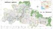
State land reclassification

 Cambodia
19 tháng 2, 2024
Nguồn: Royal Gazettes of Cambodia
Cambodia
19 tháng 2, 2024
Nguồn: Royal Gazettes of Cambodia

Dữ liệu này không có mô tả
-
Lớp phủ thực vật Việt Nam 2020
 Viet Nam
16 tháng 6, 2023
Nguồn: https://livingatlas.arcgis.com/landcover/
Dữ liệu lớp phủ thực vật Việt Nam năm 2020 được trích xuất ra từ dữ liệu lớp phủ thực vật toàn cầu của ESRI năm 2020. Dữ liệu được sử dụng học máy để phân loại thảm phủ thực vật...
Viet Nam
16 tháng 6, 2023
Nguồn: https://livingatlas.arcgis.com/landcover/
Dữ liệu lớp phủ thực vật Việt Nam năm 2020 được trích xuất ra từ dữ liệu lớp phủ thực vật toàn cầu của ESRI năm 2020. Dữ liệu được sử dụng học máy để phân loại thảm phủ thực vật...
-
Lớp phủ thực vật Việt Nam 2015 - 2018
Viet Nam
14 tháng 9, 2020
Nguồn: https://www.eorc.jaxa.jp
Bộ dữ liệu lớp phủ thực vật 2015 - 2018 tại Việt Nam là bộ dữ liệu được xử lý từ ảnh viễn thám của trung tâm vũ trụ JAXA Nhật Bản. Bộ dữ liệu đã sử dụng các bức ảnh đa thời gian...
-
-
CCI Land cover - 300 m annual global land cover time series from 1992 to 2015
Cambodia, Lao People's Democratic Republic, Myanmar, Thailand, Viet Nam
28 tháng 1, 2018
Nguồn: Climate Change Initiative (CCI) of the European Space Agency...
In the framework of the Climate Change Initiative (CCI) of the European Space Agency, the CCI Land Cover partnership is pleased to announce the official release of the CCI 300 m...
-
Regional Land Cover
Cambodia, Viet Nam, Lao People's Democratic Republic, Thailand, Myanmar, China
27 tháng 10, 2016
Nguồn: GlobCover 2009 (Global Land Cover Map) RELEASED ON 21st December...
The dataset contains a raster version of the GlobCover land cover map produced for the year 2009, clipped to the Greater Mekong Region. The land cover image is derived from the...
-
Phủ bề mặt Việt Nam 2009
Viet Nam
31 tháng 8, 2020
Nguồn: http://due.esrin.esa.int/page_globcover.php
Dữ liệu phủ bề mặt được xây dựng từ ảnh viễn thám Envisat Meris có độ phân giải là 300m năm 2009.
-
Eviction and relocation hotspots in Cambodia (2013)
Cambodia
4 tháng 10, 2015
Nguồn: Sahmakum Teang Tnaut and Save Cambodia's Wildlife. Atlas of...
 This asset provides the area of eviction hotspots and relocation hotspots in Cambodia, with raster value that demonstrates number of families affected, given by Sahmakum Teang...
-
Systematic land registration in Cambodia (2013)
Cambodia
4 tháng 10, 15
Nguồn: Ministry of Land Management, Urban Planning and Construction. Land...
 This dataset describes the status of systematic land registration in Cambodia's communes by March 2013, as given in the Cambodian Ministry of Land Management's Land...
-
Land Use. Forest Area. Cambodia, Laos, Myanmar, Thailand & Vietnam (2000-2015)
Cambodia, Lao People's Democratic Republic, Myanmar, Thailand, Viet Nam
30 tháng 6, 2018
Nguồn: © FAO 2015 Land Use. Forest Area....
This dataset contains data from the FAOSTAT for the proportion of land use related to forests in Cambodia, Laos, Myanmar, Thailand & Vietnam. It covers the years from 2000...
-
Phnom Penh urban sprawl timeline (2003-2013)
Cambodia
6 tháng 12, 2015
Nguồn: Landsat NASA 2003/13 http://landsat.gsfc.nasa.gov/
 Landsat satellite images are presented in this dataset of Phnom Penh detailing land use change in the year 2003 and 2013. Dataset were provided to Open Development Cambodia...
-
Pursat communal land use planning (CLUP) atlas 2009
Cambodia
18 tháng 4, 2017
Nguồn: Ministry of Land Management, Urban Planning and Construction...
 Pursat communal land use planning(CLUP) atlas (Chamraeun Phal, Kbal Trach, Me Tuek, Phteah Rung, Prongil, Roleab, Ta Lou, Tnaot Chum commune) is communal land use planning...
-
Koh Kong communal land use planning (CLUP) atlas 2009
Cambodia
18 tháng 4, 2017
Nguồn: Ministry of Land Management, Urban Planning and Construction...
 Koh Kong communal land use planning(CLUP) atlas (Andong Tuek, Chrouy Pras, Smach Mean Chey, Stung Veng, Tma Sa, and Trapeang Rung commune) is communal land use planning...
-
Ratanakiri communal land use planning (CLUP) atlas 2009
Cambodia
18 tháng 4, 2017
Nguồn: Ministry of Land Management, Urban Planning and Construction...
 Ratanakiri communal land use planning(CLUP) atlas (Aekakpheap, Ka Choun, Pong, Sameaki, Serei Mongkol, and Toen commune) is communal land use planning extracted from 2009...
-
Siem Reap communal land use planning (CLUP) atlas 2009
Cambodia
18 tháng 4, 2017
Nguồn: Ministry of Land Management, Urban Planning and Construction...
 Siem Reap communal land use planning(CLUP) atlas (Chan Sar, Doun Peaeng, Leang Dai, Nokor Pheas , Popel, Srae Khvav, Svay Chek, Tayaek commune) is communal land use planning...
-
Kampong Speu commune land use planning (CLUP) atlas 2009
Cambodia
29 tháng 3, 2017
Nguồn: Ministry of Land Management, Urban Planning and Construction...
Kampong Speu commune land use planning(CLUP) atlas (Kiri Vaon, Moha Sang, Honorom, Prabei Mom, Prey Khmeng, and Yea Angk commune) is communal land use planning extracted from...
-
Kampong Cham communal land use planning (CLUP) atlas 2009
Cambodia
18 tháng 4, 2017
Nguồn: Ministry of Land Management, Urban Planning and Construction...
 Kampong Cham communal land use planning(CLUP) atlas (Chikor, Moung Riev, Roang, and Srak commune) is communal land use planning extracted from 2009 contained both detailed...
-
Mondulkiri communal land use planning (CLUP) atlas 2009
Cambodia
18 tháng 4, 2017
Nguồn: Ministry of Land Management, Urban Planning and Construction...
 Mondulkiri communal land use planning(CLUP) atlas (Dak Dam, Pu Chri, Saen Monourom, Srae Ampum, Srae Khtum, and Srae Preah commune) is communal land use planning extracted from...
-
Preah Sihanouk communal land use planning (CLUP) atlas 2009
Cambodia
18 tháng 4, 2017
Nguồn: Ministry of Land Management, Urban Planning and Construction...
Preah Sihanouk communal land use planning(CLUP) atlas (Angdoung Thma, Kampenh, Outreh, Samrong, and Tomnob Rolok commune) is communal land use planning extracted from 2009...
-
Kep communal land use planning (CLUP) atlas 2009
Cambodia
18 tháng 4, 2017
Nguồn: Ministry of Land Management, Urban Planning and Construction...
Kep communal land use planning(CLUP) atlas (Angkaol, Ou Krasar, and Pong Tuek commune) is communal land use planning extracted from 2009 contained both detailed current land...

You can also access this registry using the Giao diện lập trình ứng dụng (see Văn bản API).